Change for good


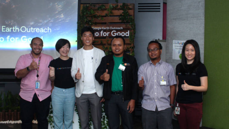
FOUR Malaysian non-profit organisations (NGOs) recently had the opportunity to share their stories through the Google Earth Outreach programme at the Google Malaysia headquarters.
The Centre for Orang Asli Concerns (COAC) together with Jaringan Orang Asal SeMalaysia (JOAS), the Malaysian Nature Society (MNS), and Rimba Ilmu presented three causes that have benefited from Google’s mapping tools.
These came after a training workshop conducted by the tech giant for the groups in late 2017.
COAC and JOAS came together with one mission in mind: to put an indigenous Jakun community in Kluang, Johor – who have been living off the land for sustenance – literally on the map.
The community of the aptly-named Kampung Peta comprises 500 people, including 80 families, living for aeons in what is now the Endau-Rompin National Park.
The community was told to vacate their ancestral land in 2012 by the Mersing land office – despite long evidence of existence – after the 1993 park establishment divided the village.
With the help of My Maps, the two organisations mapped out the border of Kampung Peta to raise awareness of its existence, and challenged the court order in 2017.
The data collected proved useful when it won its case, and negotiations led to 250 hectares of land declared as an Orang Asli reserve, while retaining access rights to 19,000 hectares of the park.
COAC coordinator Colin Nicholas said: “They [Orang Asli] have actually given up quite a lot for conservation and for the environment, but on the condition that they maintain their access rights to the forest ... and to conduct their traditional activities.”
My Maps was used to create a better visualisation of the park area which overlapped Kampung Peta.
JOAS representative Jef Antonio Suarez, who presented the Orang Asli cause, said since the technology is easy to use and share, the village is now shifting its focus to eco-tourism to promote its existence further.
Jef added: “By using this tool, it can promote all of the interesting places there [in Kampung Peta].”
One such attraction is the Buaya Sangkut waterfall, which gets its name from the structure of its rocks.
Jef hopes the rest of the country will want to experience Kampung Peta for themselves, now that it’s firmly on the map, although the project needs funding to cover more areas.
He added: “We need to promote all this to [more people] because we [couldn’t] reach these places before. By doing this … we can take interesting photos, and share it with the public.”
The botanical gardens, Rimba Ilmu, located inside the Universiti Malaya Kuala Lumpur campus, also used My Maps to provide a first glimpse into the scale of biodiversity that can be found in urban areas.
While there have been urban-based conservation efforts before, the Rimba Project found that biodiversity data on a local scale was lacking, as seen in the case of Rimba Ilmu.
This was further confirmed through discussions with residential communities, and even local authorities like the city council.
According to Rimba Project founder Benjamin Ong, they embarked on the study four years ago. Their team’s participation in the Klang Valley City Nature Challenge 2018 in April helped provide more information, through observation, documentation, and local engagement.
“When the City Nature Challenge came along, it became an opportunity for us to actually engage a wider audience on the value of collecting this very local data,” said Ong, who started this outreach and community engagement movement.
They used the iNaturalist app to gather the data, then utilised the Google Earth tool to analyse and visualise the information for communities to see.
Anyone can participate in the Rimba Project by submitting a picture of any flora or fauna in the app for its network of global enthusiasts to identify.
Ong explained: “It helps us to present [the information] in the maps and say, okay, this is the distribution and here’s where we’re finding our lizards.
“We want to kind of move the country … to start looking at the species that have been under the radar and also to see how this data can help us to track environmental change, especially in the city, because we are changing the environment rapidly.”
Meanwhile, as the oldest environmental non-profit organisation in Malaysia, MNS’ overall mission is “to promote the conservation of Malaysia’s natural heritage”.
The society used Google Earth’s satellite technology to monitor Malayan tapirs and visualise their trails.
The first survey in Bukit Tiong, Terengganu, found three tapir trails. This then led to a second survey of the area in October 2016, where two camera traps were set up.
According to MNS environment education officer Najar Habibun, tapirs are territorial, meaning there is usually only one tapir per area.
He added that news reports in February 2017 of tapirs killed in road accidents cause MNS to lose hope for the cause.
But camera traps from another MNS survey in March 2017 restored hope of tracking the fast-disappearing animal when it caught evidence of tapirs in the same area.
He said: “The good thing now is there are two tapirs – a male and a female – and they’re [expected] to mate soon.”
With the help of 32 mostly secondary school students, MNS in July this year went through thousands of photos to turn them into plot points for tapir trails using Google Earth Pro.
“The [end goal] is for the area and animal there [to be] protected,” said Najar, adding that observation and data collection is the way to help.
“The best way to conserve animals is to not disturb them,” he added.